
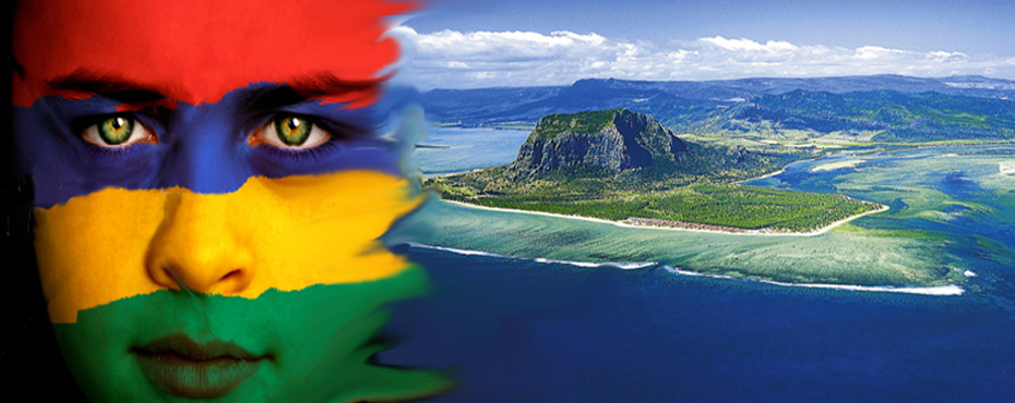
Map of Mauritius
Discover the Mauritius Map and all the best attractions per region
Mauritius Map
Use the map of Mauritius provided by Mauritius Prestige to discover the beautiful places to visit plus a list and description of interesting places to discover
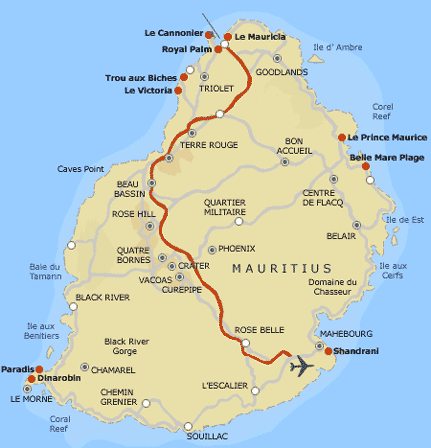
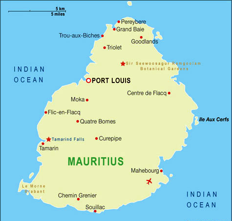
North of Mauritius Island
The North (Interesting Things to do & See)
- Grand Bay is a seaside village and a large tourist beach in the district of Rivière du Rempart on the island of Mauritius.
- Cap Malheureux Church Famous for its bright red roof this Roman Catholic Church has made this village of Cap Malheureux a very popular tourist destination.
- Trou aux Biches beach a public beach in northern coast of the island Mauritius in the district of Pamplemousses. The beach is one of the most beautiful on the island
- Pereybere Beach — A beautiful little beach popular for its calm and clear turquoise sea and with sandy beaches
- Balaclava Ruins — A few meters away from Bay aux Tortues, which 17th century sailors named after the many tortoises in the area, can be found the ruins of the old Balaclava.
- The Labourdonnais Orchards — discover a large variety of tropical fruit trees, and colorful and perfumed exotic flowers. Trips on mountain bikes or hiking are possible.
- The Caudan Waterfront — The Caudan Waterfront and its surroundings has a great collection of local souvenir shops and other foreign brand materials such as clothes, spirits
- The SSR Botanical Garden The botanical garden is the oldest botanical garden in the Southern Hemisphere. It was founded by Pierre Poivre (1719 – 1786) in 1770, contains some flora unique to Mauritius and covers an area of around 37 hectares.
East of Mauritius Island
Ile aux Cerfs — a small paradise island near Trou d’eau douce popular for water sports and has one of the most beautiful beaches in Mauritius. You cannot afford to miss this tiny island, delicately poised on the Indian Ocean, a real pearl in the Mauritian landscape. There is a variety of vessels that serve the route including catamarans, yachts and speed boat
South East of Mauritius Island
- Dutch Ruins — Vieux Grand Port, the oldest settlement in Mauritius, you can see the ruins of the first Dutch fortifications.
- Ile aux Aigrettes —Wildlife Foundation a preserve site, the island has become an international standard for the protection of natural resources and endangered species.
- Domaine du Chasseur, in the Anse Jonchée hills, the Domaine des Grand Bois has splendid hunting grounds covering an area of 900 hectares. Stags, monkeys and boars live amidst the luxuriant vegetation of the hillside.
- Blue Bay beach — clear blue sea and white sandy beaches, Blue Bay Marine Park is a must see! There you will find rare corals and fish species in a depth of 5.5 meters.
West of Mauritius Island
- Flic en Flac — beautiful Beach in the west of Mauritius Flic en Flac extends across 8 km of beaches that extend to Wolmar
- Martello Towers — at La Preneuse, Black River, represent the ancient rivalry between old colonial powers and the ingenuity of mankind. They are a milestone in the island’s history; they symbolize the end of slavery and the beginning of Indian immigration.
- Chamarel —the colored earths of Chamarel: an undulating landscape of different and contrasting shades of colors. The different shades of blue, green, red and yellow are apparently the result of the erosion of the volcanic ash.
- Salt Pans of Tamarin — the exceptional high level of sunshine that the district received make it ideal for the salt production.
- Casela Situated in the Black river district, the Casela Nature & Leisure Park stretches over 25 hectares.
- Yemen Yemen Reserve one oft be the largest game reserve on the island.
- Black River Gorges This national park of 6,574 hectares (16,244 acres) was created in 1994 for the protection of Mauritius’ remaining native forests.
- Eureka is an old Creole residence built in 1830